A pay-per-shower facility seems preposterous if you’ve been taking baths without paying, but it isn’t if you’ve been wearing the same clothes for a while. However, even the thought of showering at Great Basin National Park in Nevada is pointless because it doesn’t have the shower facilities that Bryce Canyon National Park in Utah does. What sounded crazy was being charged $3 for an eight-minute shower at Bryce Canyon.
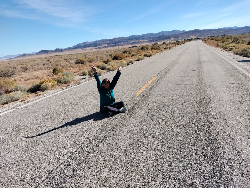
The author about to set off on off-the-beaten track in the US (Photo courtesy of Liana Garcellano)
The eponymous homesteader of Utah’s national park, Ebenezer Bryce, wouldn’t have timed his bath because he wouldn’t have bathed regularly. Bathing was, first, a luxury because water was scarce. Second, the shipwright was preoccupied with building a cabin (churches, too) for his family every time his church tasked him to start a new settlement. The Mormon left Scotland for Utah in the mid-19th century and settled in the Bryce Canyon area in 1875 with his family, according to a sign in the park.
To allay my disbelief, Michael Levin told me that an eight-minute shower is long and that he’d showered for a shorter time. With that, he handed Charro Jambalos and me our tokens and headed to the left side of the General Store where the men’s shower cubicles were. We headed to the right. Along the way, Charro reminded me to slot the token in only when I was ready to shower so I’d have enough water.
Longtime friends Michael and Charro took me camping in Nevada and Utah when I visited them in California late last year. Their off-the-beaten-track itinerary eclipsed most travel programs of tourists vacationing in the United States.
To get to Great Basin, Charro took Highway 50, a road stretching from West Sacramento, California, to Ocean City, Maryland, and labeled “The Loneliest Road in America” by Life magazine in July 1986 apparently because of its barren environment.
On hindsight I realized the reason for the choice of route: a subtle acclimation to the wilderness, with Highway 50’s desolate terrain looking incongruous against the usual colorful American landscapes. It was by mistake that Charro and Michael found themselves on the highway the first time. They were looking for a hotel and couldn’t find one, so she just kept driving. Now, back on the highway again, she told me its smooth road made it safe for bikers and cyclists on e-bikes.
I thought Austin was a town out of a Hallmark TV movie—the small town a girl leaves for the big city only to return to it after a heartbreak
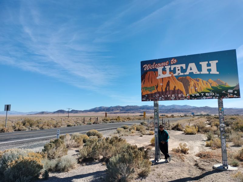
An alternative route was Interstate 80, but it’d have made the drive longer, taking us to Salt Lake City, which wasn’t where we wanted to go. Highway 50 was a pragmatic choice because it’d take us to the middle southern part of Utah towards Bryce Canyon. It’s said that people from Utah, especially those who like to gamble or engage in other activities considered illegal in the state, took 80 to leave Utah, quipped Michael.
We passed the first two of the three small towns—Austin, Ely, and Eureka—on a stretch of Highway 50 in Utah. Ely (pronounced Ee-Lee) was a break in the journey between Reno, Nevada—where we overnighted—and Great Basin. The road to Ely was deserted, the dreariness sharpened by overcast skies. Charro kept the rented GMC Terrain’s headlights switched on even in daytime to alert cars on the opposite side. A 10-wheeler truck dwarfed the Terrain occasionally. We spotted highway patrol cars on both sides of the road once, but most of the time we saw black cows dotting the landscape.
I thought Austin was a town out of a Hallmark TV movie—you know, the small town a girl leaves for the big city only to return to it after a heartbreak. There’s nothing wrong with such towns, except for political atavism. A pickup truck parked in front of a house had a huge Trump flag fluttering in the wind.
The giant ovens, measuring 30 feet high and 27 feet wide, were operational from 1876 to 1879— shelters against inclement weather and hideouts for stagecoach bandits
Ely vibed capitalism: The neon signs of McDonald’s, casinos, and motels (White Pine, El Pinko, La Quinta) were beacons to fatigued travelers. Casinos were ubiquitous and a few were a stone’s throw away from White Pine Middle School. Ely is essentially for resting and stocking up on essentials (including chewing gum) if gambling isn’t your cup of tea.
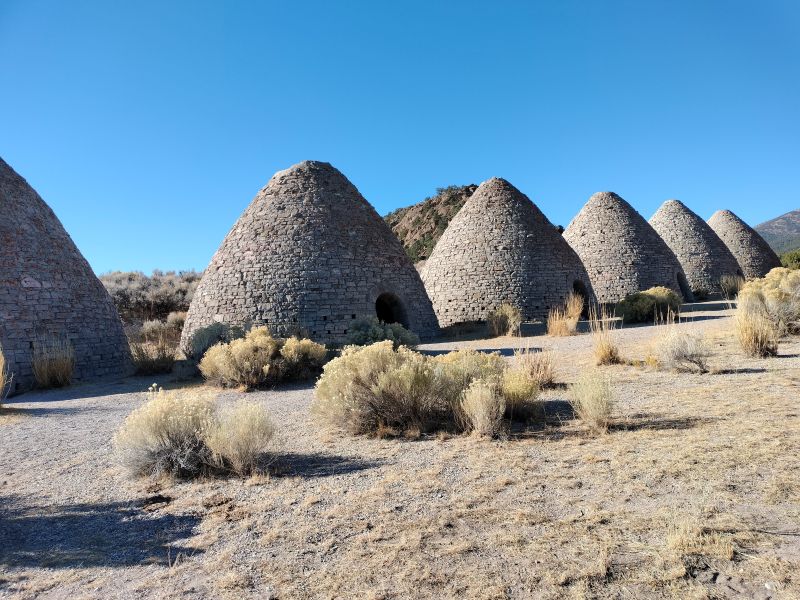
Ward Charcoal Ovens measuring 30 feet high and 27 feet wide
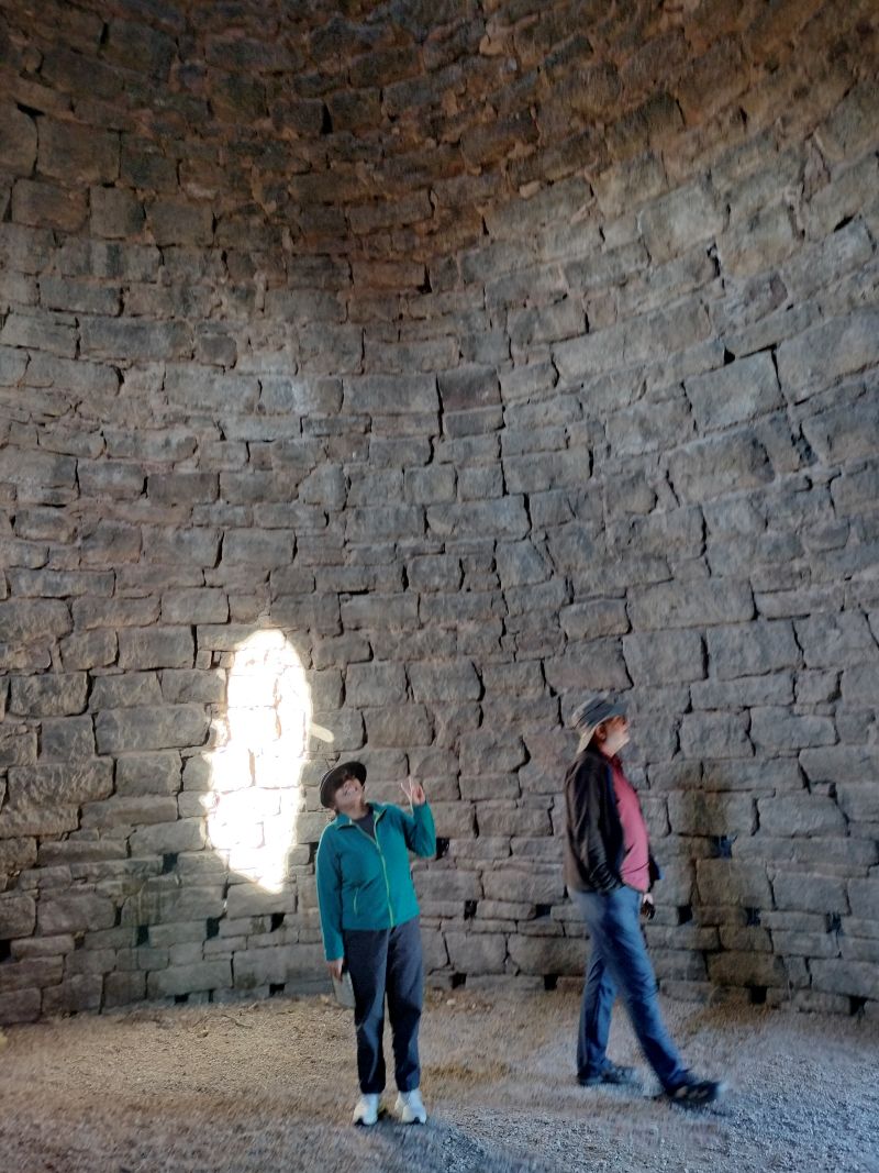
Inside the charcoal ovens (Photo courtesy of Liana Garcellano)
However, it’s different outside of Ely’s town proper, where you get a close look at America’s salvo of (conscious?) deforestation. Ward Charcoal Ovens State Historic Park along Willow Creek was a quick a history lesson on environmental deterioration in the time of outlaws.
An explanation sign said the giant ovens, measuring 30 feet high and 27 feet wide, were operational from 1876 to 1879. They were conveniently located within three miles of the smelters. An abundance of silver ore was discovered in the area, and charcoal was needed to process it. The ovens became shelters against inclement weather and hideouts for stagecoach bandits when the silver boom waned and the land was denuded of trees.
A second sign explained that the trees at the beginning of the Willow Creek trail behind the ovens were second-growth pinyon-juniper woodland that flourished after the depletion of the primary (aka old) growth due to harvesting (such as the case in Ely), forest fires, or insect infestation.
Another sign detailed that the six beehive-shaped ovens were built from charcoal oven tuff quarried from the land. Each oven burned 35 cords of wood for 12 days. A cord produced 50 bushels, and so, 35 cords equaled 1,750 bushels of charcoal, or an equivalent of 28,000 logs. All in all, the six ovens yielded 10,500 bushels of charcoal from 168,000 logs. (A cord converts to 128 cubic feet of stacked wood or a pile of wood 4 feet high, 4 feet wide, and 8 feet long.)
Compared to a lighted open pit, the ovens were deemed better in making charcoal because it made it easier to control how hot or long the fire burned—important details in producing quality charcoal—through the vents. The side entrances were sealed with cast iron doors and mortared after the wood was stacked and lighted. When the burning was finished, the ovens were completely sealed for a day to cool down before the charcoal was collected. To restart the process, the ovens were relined with mortar (nevadamagazine.com).
Campground choices: Great Basin is a notch above primitive
Departing from Great Basin for Bryce Canyon was going back to the future after two nights of wilderness living. Camping at Great Basin was almost like “free camping” on a BLM site. Generally, BLM campsites are managed by the Bureau of Land Management, and some sites are without camp facilities—not even garbage bins. BLM sites are for people who like “free camping” and bringing a shovel for the toilet. Great Basin is a notch above primitive. Several steps away from our campsite at Baker’s Creek stood two toilets, with the water source a 15-minute drive away.
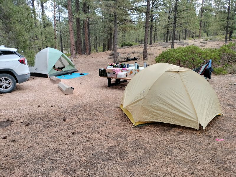
Bryce Canyon tents
In contrast, Bryce Canyon was camping in the woods, but in proximity with urban comforts. The developed campground has a lodge (if sleeping in a tent is unthinkable) with free WiFi, shower and laundry facilities, and a General Store selling everything you think you need while living in the woods (firewood was $7.25/bundle).
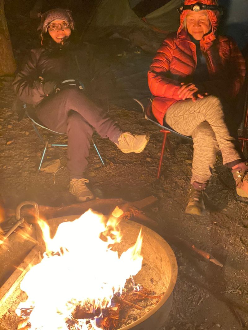
The author before the Great Basin campfire
We found our campsite in Sunset Campground at Loop B after driving around for 30 minutes. Bryce Canyon doesn’t have campsite reservations unlike Great Basin, but the space isn’t yours unless the card given by the hosts (volunteers who assist park staff) is filled out and clipped to the campsite pole. To pay, we walked to the Registration Kiosk to the collection box at night and dropped the envelope with $30 ($15 a night) in it. We only had our personal headlamps to light our path.
Campsite #270 had a picnic table, fire grate, and ample space for two tents. Across it was a clean, motion-detector restroom (the lights switched on when one entered), which was adjacent to the service sink area with separate sinks for washing and rinsing, and warm running water. Washing our kitchenware was tougher at Great Basin. We had to drive to the Lehman Caves Visitor Center to collect water then cart it back to campsite #8, our home base. It was already late in October and water at the campground was available only during the summer.
The hosts at Bryce Canyon went around in a buggy to see if campers needed help and to check for violations of campground rules. Host W. Elliot left us a warning letter when we were away at the General Store. We hurriedly removed the dish cloths we’d innocently draped on the shrubs to dry, not wanting any law enforcement action taken on us.
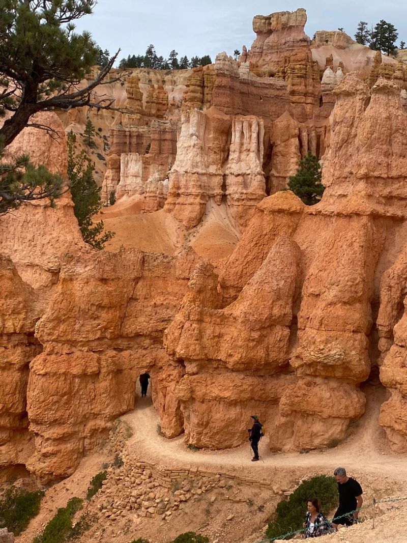
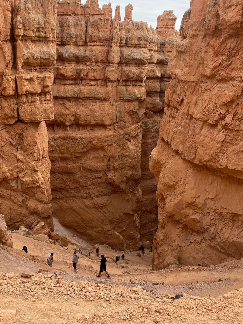
Walking the trails of the hoodoos—aka earth pyramids, tent rocks, or fairy chimneys—is the essence of camping at Bryce Canyon
Walking the trails of the hoodoos—aka earth pyramids, tent rocks, or fairy chimneys—is the essence of camping at Bryce Canyon. The national park has more of the hoodoos than the Colorado plateaus, the badlands of the Northern Great Plains, Canada, or France.
Hoodoos are these spectacular rock towers in hues of vermillion, orange, and tangerine measuring between 5 and 150 feet. A sign explained that wind and water (ice, rain, snow) sculpted the rock formations millions of years ago, eroding the edge of the high plateau at a rate of 1 to 4 feet every century and resulting in rock projections called “fins.” Through “frost wedging,” a process where melted snow and rain trickle through the cracks that expand when the water turns into ice, holes called “windows” formed in the fins. As the “windows” further eroded, the cap rock collapsed and left isolated towers, or hoodoos, with intriguing irregular shapes and stunning colors.
Conversely, Great Basin isn’t a park in which to enthuse about nature’s colorful structures. You don’t get to muse on aesthetics when you constantly grapple with the park’s Arctic temperature and a persistent desire to nap. Likewise, hiking the rocky terrain isn’t encouraging especially with the undeveloped trails and the niggling thought you might stumble upon the Great Basin rattlesnake. If I hadn’t lucked out on the Lehman Caves tour tickets, which are always sold out, I would have seen up close what the brochure called the rare speleothems (cave formations) of shields, welts, and turnip stalactites inside the caves. Instead, I had a vicarious experience walking through the simulated cave at the visitor center.
I got going on a rhythmic movement of planting my trekking poles on the unpaved path
Hoodoos have you pondering on America’s distant past where the environment was the formidable enemy and faith in a deity was the ultimate weapon. Tourists have it easy walking the hoodoos because the trails are already established.
Bryce Canyon Queens Garden Trail
The Queen’s Garden Trail at Sunrise Point is described as an easy 0.9 mile one-way hike. Truly, it wasn’t difficult slowly descending to the rim of the amphitheater (part of the park with the largest collection of hoodoos), which was made doubly easier with my REI trekking poles. The trail followed a ridge that ended at the Queen Victoria hoodoo, a spot where hikers collectively gathered to rest, eat, and drink before heading out again. Chipmunks darted within sight from where Michael and I sat, while Charro struck up a conversation with a family from France whose one member I’d watched intently earlier on. He’d hiked the trail as if he were on a leisurely stroll despite having his young daughter strapped to his back.
Bryce Canyon start of Navajo Trail
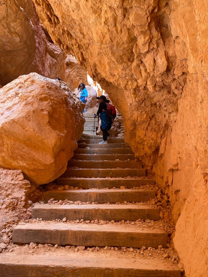
The challenge was when we combined the Queen’s Garden Trail with the Navajo Loop Trail to get back to where we started. Traversing the Navajo Loop’s fascinating yet daunting switchback was a cautious ascend on the narrow footpath where you either picked up your pace when the ones behind you were eager to get ahead, or turned sideways to let the ones coming down from up the path pass through. It was foolish rushing or outpacing the other hikers on a gravelly footpath without handrails. Besides, Charro said to take my time in going up.
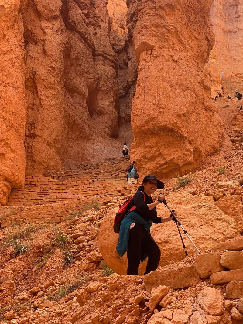
Bryce Canyon Navajo Trail: ‘Rhythmic movement of planting my trekking poles’ (Photos courtesy of Liana Garcellano)
I got going on a rhythmic movement of planting my trekking poles on the unpaved path and propelling myself upward, repeating it until I reached the top. Another hiker once reached for my poles, jokingly asking if he could have them when I stopped at a corner for a breather. I said no, smiling.
Thinking back, I’m sure it was no hike for Ebenezer Bryce and family who lived in the amphitheater. He fashioned the trails that hikers now tread on. He built a road to harvest the lumber, per a park sign. He constructed a trail when his church asked him to move with his family to Paria Valley, and guided the building of a 17-mile irrigation canal from Paria Creek (brycecanyoncounty.com).
More questions than answers came after walking the Willow Creek Trail in Ely
That the weather in California and Utah wasn’t humid lent a conducive air to learning while trekking through the hoodoos. Everything’s copacetic when you haven’t showered for days but don’t reek to high heavens even. Lesson one: You adjust to the wilderness, not the other way around. It was petty thinking of a bath after a hike, accessing WiFi, or needing trekking poles (I used a branch a friend handed me while hiking in Indonesia).
For contemporary campers, trekking is purely recreational, as opposed to Ebenezer Bryce et al. who went up and down the hoodoos with no fancy gear. Physical strength, wits, and sheer determination got them through five years of living in the hoodoos before relocating to Arizona in 1880. (A sign in the amphitheater described Ebenezer and wife Mary as serial homesteaders who achieved an incredible feat by frontier standards of pioneering 12 locations in Utah and Arizona while raising 12 children.)
More questions than answers came after walking the Willow Creek Trail in Ely. An entire woodland of pinyon-juniper trees took 145 years to grow around the charcoal ovens after being felled to make charcoal. Will the current natural environment recover? Will the deforestation ever stop? When did the locals become aware of air pollution and its detrimental effects? It’s only common knowledge nowadays that air pollution, among other things, is caused by deforestation and leads to health problems.
Even the campaign for the recent US presidential election, which held hope for all that’s good in the world, added to the atmosphere of learning. That changed with the post-election scenario. Humid or not, what happens to the environment and humanity now?


