
After living with her map collection for over two decades, Kitty Go felt it was a good time to pass them on to other collectors. (Contributed photo)
Magazine publishing pioneer, editor, writer Kitty Go is unveiling her private collection of antique Philippine maps in Mapper’s Delight, April 23 to 26, 2026, at Vetted, Mile Long Bldg., Makati.
How did this style arbiter of the 2000s, who left Manila to live abroad, get drawn into collecting maps? “Twenty years ago, maps were inexpensive and flexible way to decorate, as you will read in the book to be launched at the sale,” she told TheDiarist.ph.
“So I started with one, then bought them slowly for some reason/opportunity or another until I ended up with 15.”
These 15 antique Philippine maps offer a glimpse of an era when cartographers—not satellites—were defining the physical world.
For the digital native, the idea of navigating with a printed map feels like a scene from a period movie. Today, we are the “blue dots” on a glowing screen, guided by voices and real-time data. But before Google, Apple, or Waze, exploring the Philippine archipelago required something much more tactile—and much more beautiful.
This selling exhibition from April 23 to 26 is a rare window into this analog world.
Go views these maps as more than just ink and parchment, but also as portals to a vanished world. She notes in the book accompanying the exhibition, “Every sheet is a precious story of commerce, art, culture, and history in one page.”
Beyond their historical weight, these pieces are inherently decorative—designed to serve as both visual anchors and sophisticated conversation starters in modern interior spaces. “What I like about these maps is that you don’t really need to know about maps to like them,” Go says, “because they are visually appealing.
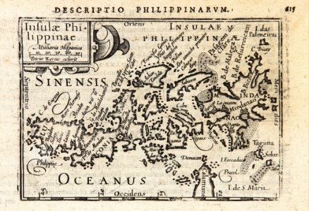
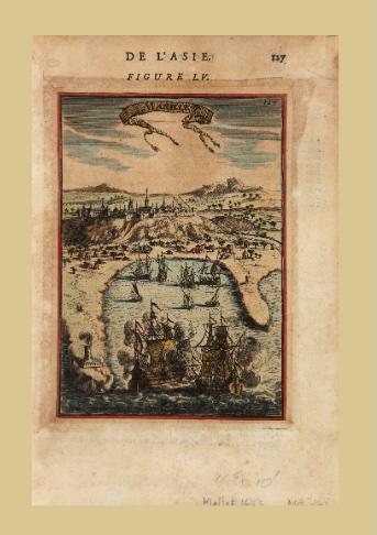
Two of the earliest cartographical samples include ‘Insulae Philipinae’ (Philippine Islands), Petrus Kaerius’ ca 1598 map that shows the country on its side (left), and Alain Manesson Mallet’s ‘Manille,’ (‘De L’Asie Figure LV,’ from the book Description de l’Univers, 1683).
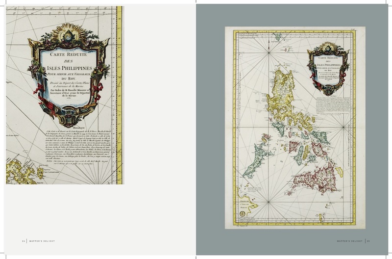
The jewels of the collection include two iterations of the legendary Murillo Velarde map, widely regarded as the “Mother of all Philippine Maps.” Collectors will find the 1760 Homann Heirs version alongside Jacques-Nicolas Bellin’s 1752 scaled-down rendition. Another fascinating highlight is Bellin’s map of the Visayas and Mindanao, which features the mysterious island of “St. Jean” (San Juan)—an enigma modern scholars now believe was actually a mislabeled Siargao.
These two Bellin maps, where Luzon and Mindanao are shown separated, resonate with Go. “They were great conversation starters all over the world—Filipinos immediately knew half the country was missing, and non-Filipinos appreciated the connection between the two if they didn’t know what our archipelago looked like,” Go told TheDiarist.ph.
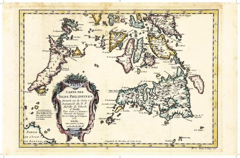
Jacques-Nicolas Bellin’s 1750s map of the Visayas and Mindanao, which features a mysterious island labeled ‘St. Jean.’
Two very early cartographic samples take the viewer farther back in time. Petrus Kaerius’ Insulae Philippinae (1598) is the first individual map of the Philippines, famously depicted on its side to earn the enduring nickname of “tagilid” map. Alain Manneson Mallet’s Manille (1683, from the book Description de l’Univers) vividly captures the dual forces of the Spanish era—the Catholic Church and the Spanish armada—with a settlement nestled between them.
To deepen the cultural conversation, Vetted will host an exclusive talk, The Legacy of the Society of Jesus on the Cartography of China and the Philippines, on April 25, 4pm. Open to the public with an allocation for 40 registrants, it features the linguist and renowned expert in historical cartography, Dr. Marco Caboara, who will discuss the intersection of religion and geography in Philippine mapping.
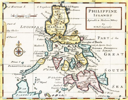
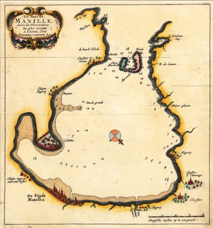
Herman Moll’s ‘Philippine Islands’ (1720) featuring a unique horizontal orientation of the Bicol Peninsula (left); ‘La Baie de Manille’ (Manila Bay) map by Peter Van Der AA, ca 1729.
Having lived with the maps for over two decades, Go went through a transition from being a former journalist to being an art custodian. “I do not consider myself a collector, but a mere custodian because maps, as well as any form of art, have their own lives and should be circulated among those who can benefit from them in public or private,” Go says. “It is time for these maps to go under the stewardship of others, to those who will have greater appreciation for them than I can ever have.”
Mapper’s Delight runs April 23 to 26, with viewing from 11am to 7pm, at Vetted, Unit 126 Mile Long Bldg., Amorsolo St. corner V. Rufino St., Makati City . For inquiries, 0917 5262339.


